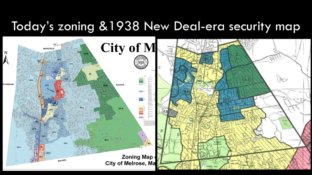
Melrose’s built environment and growth patterns before and since redlining, presented on February 7, 2018 and January 21, 2019
On two different occasions, in I gave a presentation on structural segregation and the built environment in Melrose, Massachusetts, first for MORE: Melrose, Organizes for Real Equality in February 2018, and later, as part of an Act for Racial Justice Panel on Martin Luther King Day in January 2019. During both of these presentations, I challenged the audience to first develop a mental map/picture of Melrose and surrounding communities, and think about patterns they’ve observed, stereotypes they’ve heard about different neighborhoods, and to share their personal experiences. Then, I shared historic and present day maps to show how patterns of racial and economic segregation, visible on maps of land use policies, have persisted for over a century.